Workflow · 3ds Max, Corona
Masterplan aerial renders that read as design, not surveillance
The 45 degree camera, the shadow story, and the entourage density that makes a masterplan look occupied. A top down workflow for urban design.
 WORKFLOW
Masterplan renders live or die in the first three seconds. A planning committee scrolling through a submission gives each image about the length of one blink before deciding whether to slow down. That means the composition, the shadow, and the sense of occupation have to communicate at a glance, not over careful study. This is different work from a photorealistic elevation, and it needs a different approach.
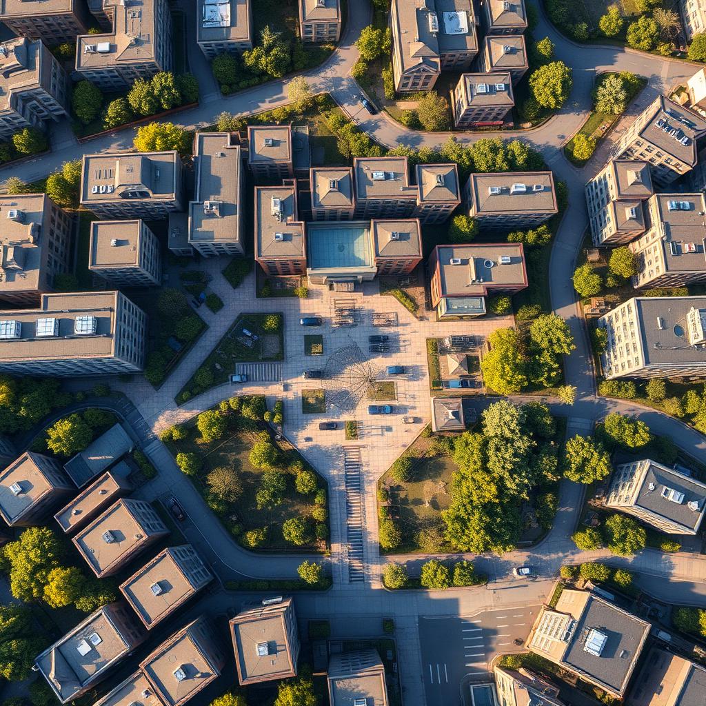
The first decision is the camera angle. A true plan view at 90 degrees reads as a drawing, not a render, and defeats the purpose of building the model at all. A 45 degree oblique reads as a video game map. What works is somewhere between 60 and 70 degrees from horizontal, high enough that you see the roofscape but low enough that you still read the massing and the street elevations. On this frame I settled on 65 degrees at 60m elevation, which is roughly the perspective of a low helicopter or a tall crane camera.
Sun angle is the second major decision and the one most artists get wrong. Midday sun on an aerial gives you flat roofs and no reading of massing. Low sun gives you long shadows but loses the plaza floors to darkness. The right window is 9am to 10am or 3pm to 4pm depending on the site orientation. On this scene, 9am sun gives me shadow depth along the eastern building faces and warmth on the plaza floor, which reads as morning life rather than surveillance photography.
The shadow story is what makes an aerial render look designed. Buildings cast shadows that reveal the section depths, the setbacks, and the massing hierarchy that a plan drawing hides. Trees cast shadows that mark the pedestrian zones. If your aerial has no shadows because you chose noon sun to avoid dealing with them, you have thrown away the most powerful design communication tool the medium offers.
Entourage density on a masterplan is a specific art. Too few people and the scheme reads as depopulated dystopia. Too many and it reads as a busy street market that no one wants to live near. Aim for one visible person per 50 to 100 square metres of active public space, none in the private courtyards, and cluster them in ways that read as purposeful. A group of three at the café terrace, a couple crossing the plaza, a person on a bike heading toward the school. These small stories give the image narrative without over populating it.
Cars are the entourage that most masterplan renders overdose on. Two cars per parking space in a rendered aerial reads as chaos. Show cars in the loading bays, a couple on the streets, and leave the marked spaces mostly empty. If the scheme is genuinely car free, show none. Committee members read cars as an implicit statement about how the scheme wants to be lived in, and every car in the render is answering that question whether you meant to or not.
Trees deserve a strategy. Show them at their planted size, not their mature size. A masterplan render with fully mature trees reads as a lie, because everyone on the committee knows that the trees on day one will be saplings. If you show them at year one, then include a second render at year ten in the same submission. Managing the temporal narrative of a masterplan is your job, and rendering it into the images is the strongest way to do it.
For the water bodies and paved plazas, keep reflections subtle. High reflection on a large paved surface at aerial angle creates a visual noise that competes with the buildings. Bump the roughness on plaza floors to around 0.75 and let them read as texture, not mirror. Water can be more reflective, but only if the reflection contains something useful, such as the tallest building in the scheme catching the morning light.
The last note is about resolution. An aerial masterplan render is often printed at A0 or projected at 6m wide for a committee presentation. Render at least at 5000 pixels wide, ideally 8000. The extra render time is not optional. A pixelated aerial in a public meeting is the reputational hit that stays with the studio for years.