Workflow · 3ds Max
Context modelling for planning renders: how much neighbourhood is enough
Planning imagery is judged against a photograph of the real street. A practical standard for context accuracy, verified views, and the details committees actually question.
 WORKFLOW
A planning image is not a marketing image. It is evidence, and it gets compared against a photograph of the real street by people whose job is to find discrepancies. That changes almost every decision, starting with how much of the neighbourhood you model and to what standard.
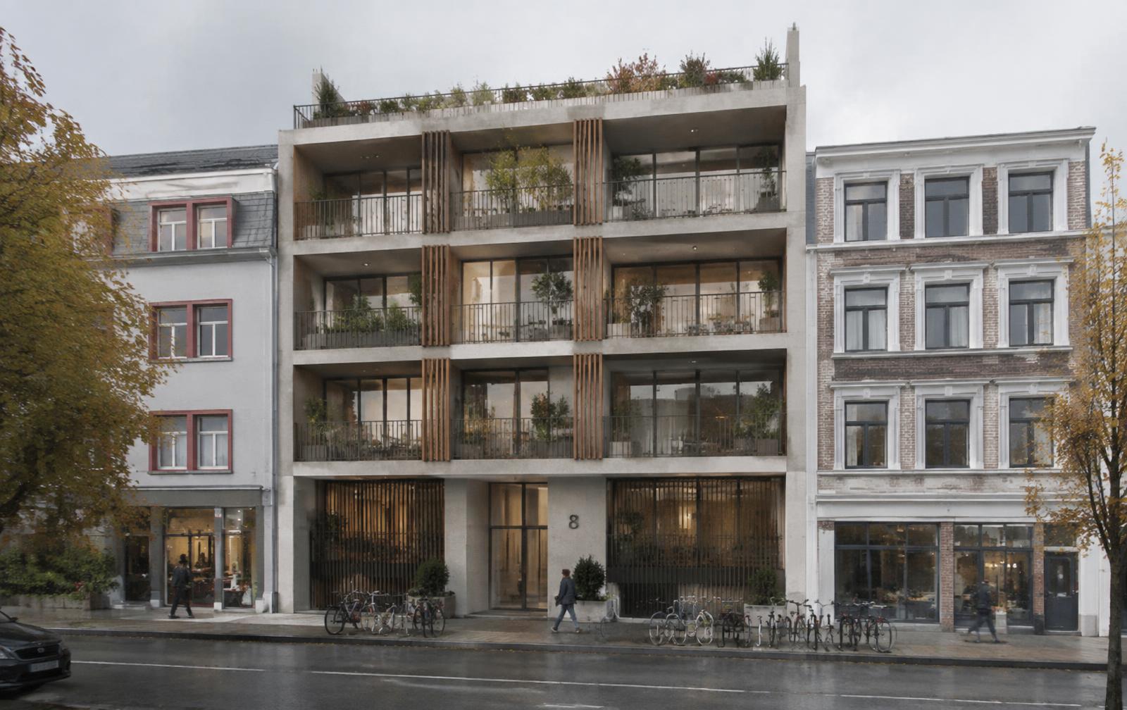
The honest rule is that context should be built to the same level of quality as the proposal within the primary field of view. If the new building has modelled reveals, window frames with depth, and correct material scale, and the building next door is a flat box with a photograph stretched over it, the eye will read the proposal as more refined than it can possibly be. That is exactly the criticism planning officers raise.
Beyond the primary field, quality can taper. Buildings at the edge of frame or heavily occluded can be simple massing with a good texture and correct roof geometry. What they cannot be is the wrong height or the wrong footprint, because that is checkable against survey data and it undermines the whole submission if caught.
Verified views raise the bar further. These require a surveyed camera position, a known focal length, and a matched photograph, and the model has to line up against real survey points. If a project is heading toward a verified view process, involve the surveyor before you set any camera. Trying to reverse engineer a camera match from an unsurveyed photograph is slow, imprecise, and easy for an objector to challenge.
Weather and light choice carry an ethical dimension in planning work. A scheme lit by golden hour sun with a warm graded sky reads as advocacy. Overcast or mild diffuse daylight reads as neutral documentation, and it is usually what planning authorities prefer because it does not flatter. Save the dramatic dusk imagery for the sales brochure.
Ground plane accuracy matters more in street level work than anywhere else. Kerb heights, pavement widths, crossing positions, drainage gullies, and the actual road camber all sit in the lower third of the frame and are directly comparable against the photo. Getting the kerb wrong by 80 millimeters is visible when the image sits next to a site photograph.
Street furniture and infrastructure make or break credibility. Lamp columns, signage, bins, bollards, tactile paving, and utility covers exist on every real street and their absence produces an oddly sterile image. Model them roughly to the correct size and position from survey and photography. Nobody examines the bin, but everybody notices when the street has none.
Vegetation must reflect reality and season. If mature street trees exist, they screen the proposal, and omitting them overstates the visual impact. Including trees in full summer leaf when the assessment year is winter understates it. Many authorities now request both summer and winter versions of key views for precisely this reason, so plan the tree assets accordingly.
Parked cars are a small honesty test. Real urban streets have them. Removing every vehicle produces a wider, calmer street than exists and makes the proposal seem less dominant. Include a plausible number of parked vehicles of an ordinary age and type, and avoid filling the kerb with recent luxury models.
Keep a record of your sources. Survey data, photography dates, camera specifications, and material references may need to be produced if the imagery is questioned. A simple methodology note filed alongside the render is cheap insurance and it demonstrates that the imagery was produced to a defensible standard rather than assembled by eye.
Treat the whole thing as documentation with a high production value rather than as persuasion. The images that survive scrutiny are the ones where nothing has been quietly improved, and that reputation is worth more over a career than any single flattering frame.